Mapping Earthquakes in QGIS
Analysing earthquake data (Introduction to QGIS course, Part 1)
Introduction to QGIS Part 1
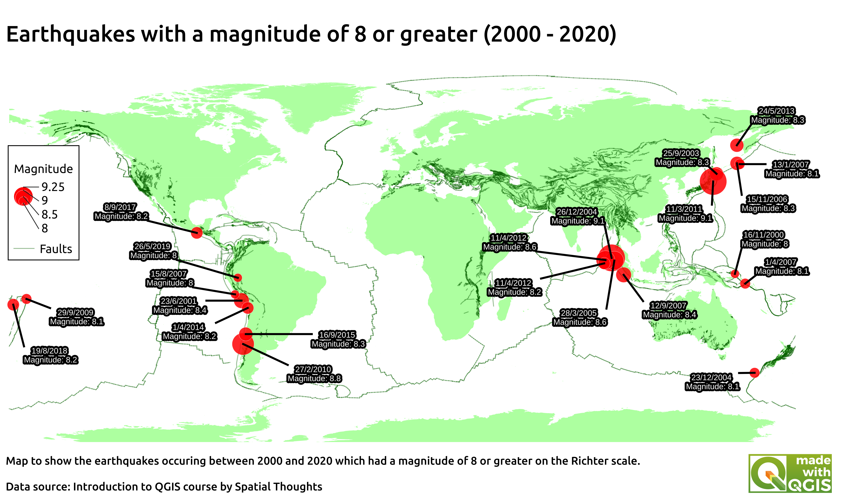
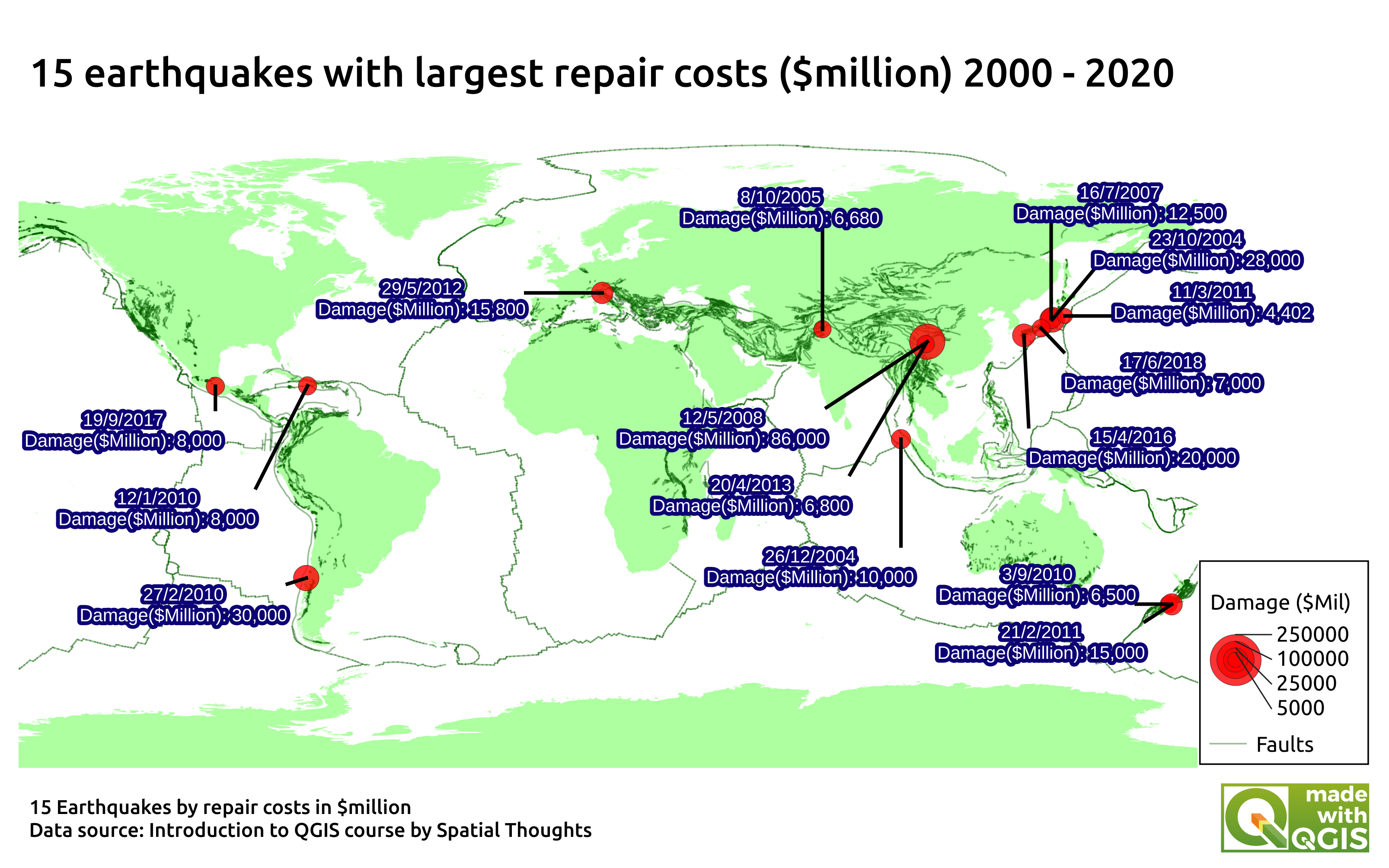
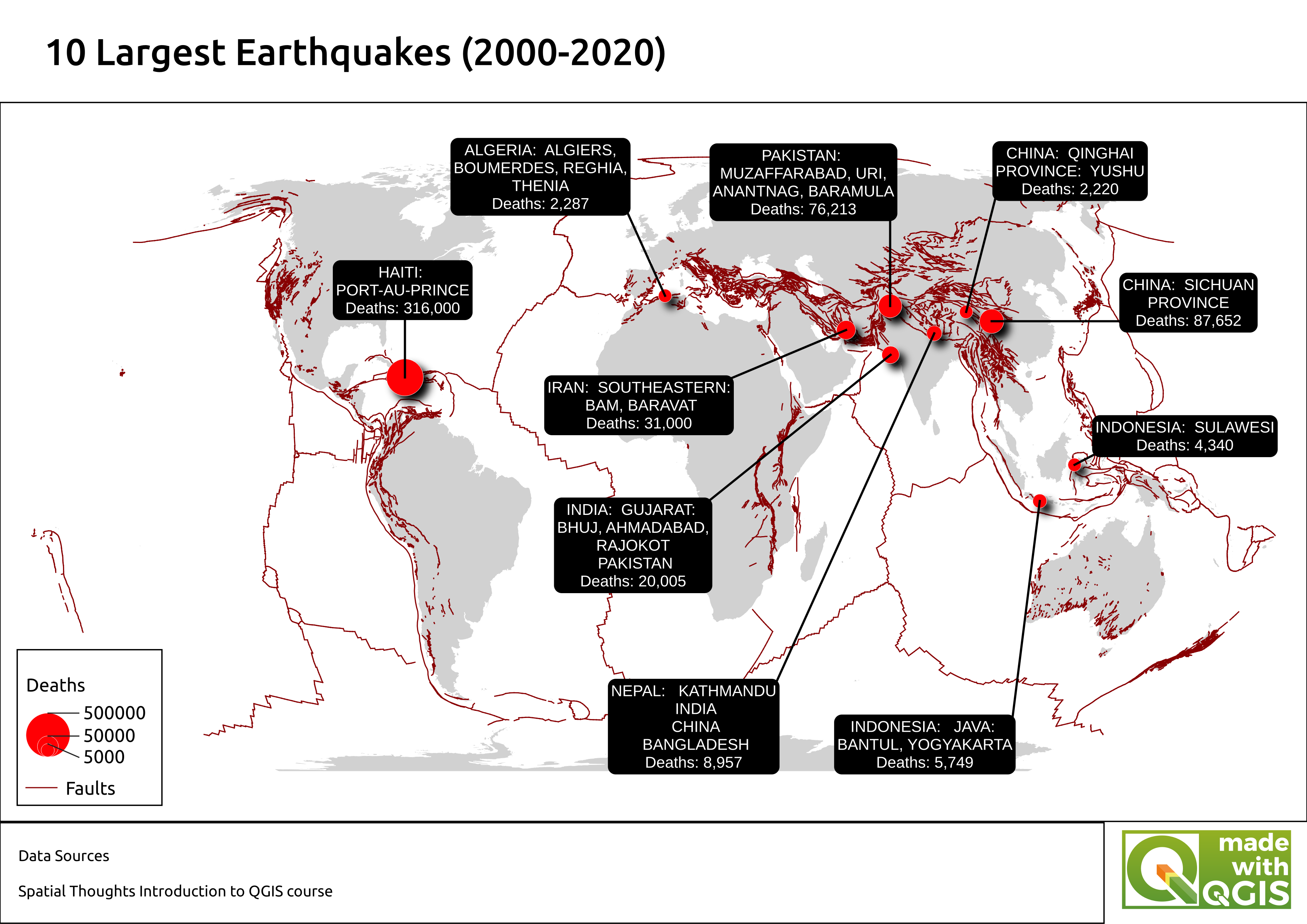
This project was part of the Introduction to QGIS course (Part 1) by Spatial Thoughts. In this section of the course, methods of importing different vector and text files were introduced, along with methods of customising different layers. A general understanding of some of the common features of QGIS was obtained. Multiple vector layers (World map and Faultlines) were combined with data on earthquakes between 2000 and 2020. The data was filtered into a new layer which depicted the 10 most serious earthquakes by fatalities since 2000. Labels were added to the data and marker sizes were adjusted according to fatalities, before a legend was added. The final file was then exported as a .png file and can be seen above. A variety of other maps were then created utilising this same data in order to practice these skills (see below).