Mapping lost lakes in QGIS
Mapping lost lakes in Bangalore (Introduction to QGIS course, Part 4)
Introduction to QGIS Part 4
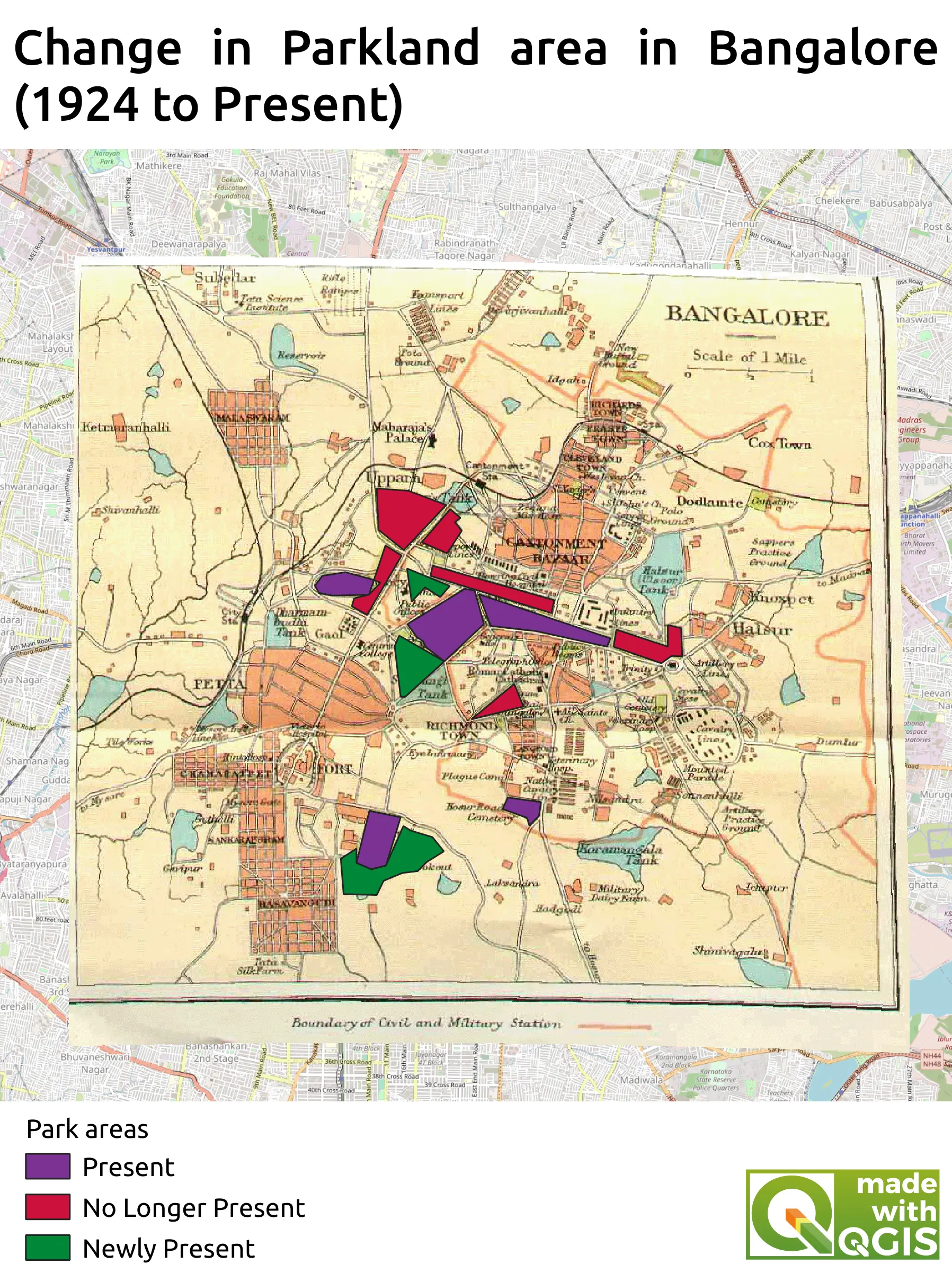
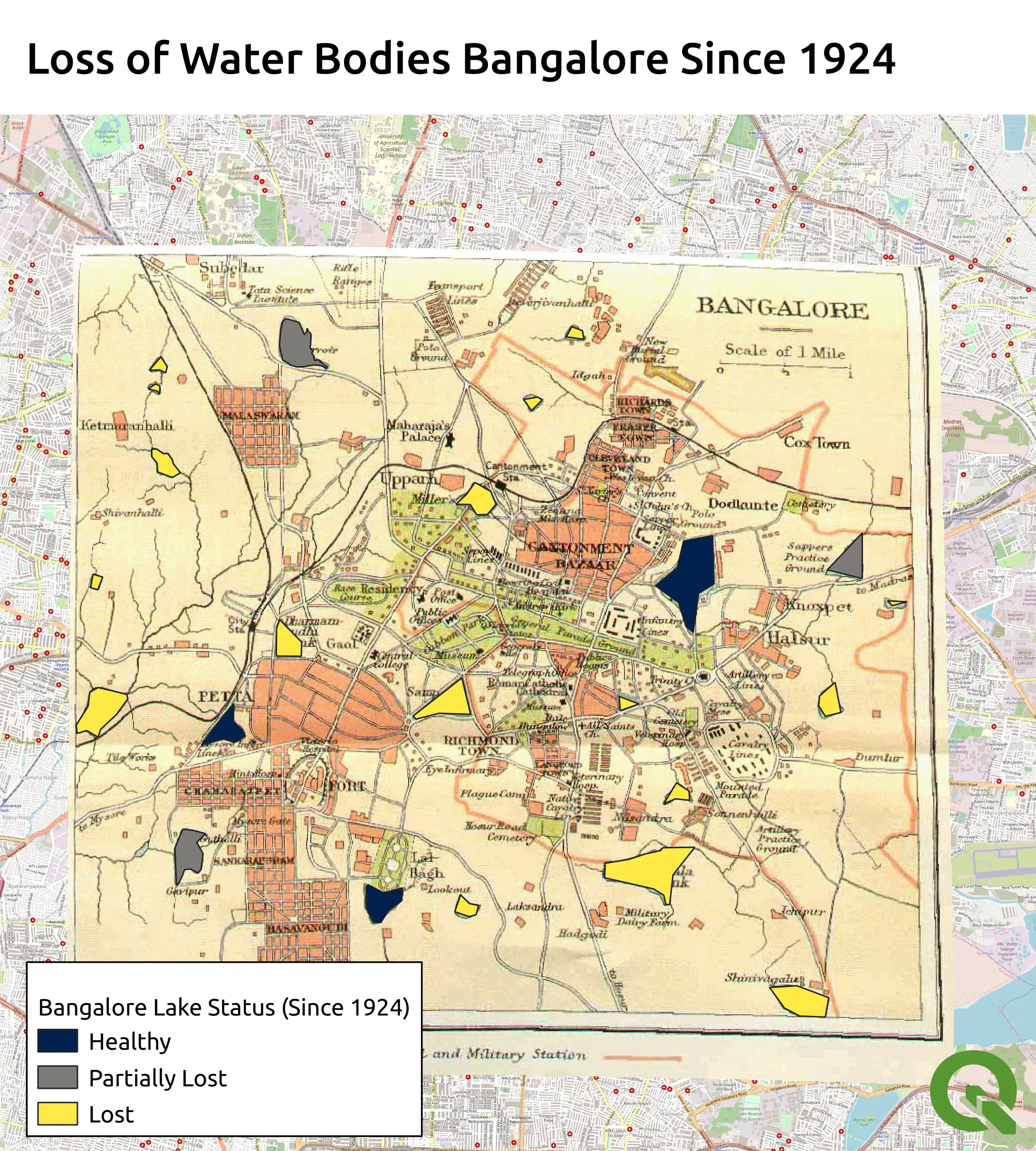
This project was part of the Introduction to QGIS course (Part 4) by Spatial Thoughts. In this section of the course, a 1924 map of Bangalore, India, was used as a reference to monitor the loss of water bodies as a result of urbanisation. In order to achieve this, a new Geopackage layer was created and the editing tool (from the digitising toolbar) was used to mark out water bodies which were present in the 1924 map of Bangalore. The marked data of each water body present in 1924 was added to the newly created layer, along with an associated status of whether the water was still present, partially lost or completely lost. The lake status input was made to be a drop down selection by using the value map widget in the field editor (in properties). Once each individual water body had been marked, the layer was coloured with a categorised style so that water bodies could be easily viewed and selected according to their status. This layer could then be used to compare with the modern day OSM map. Following this, the procedure was repeated for park areas to practice these skills.