Measuring Highways in QGIS
Measuring Highways in QGIS (Advanced QGIS course, Part 1)
Advanced QGIS Part 1
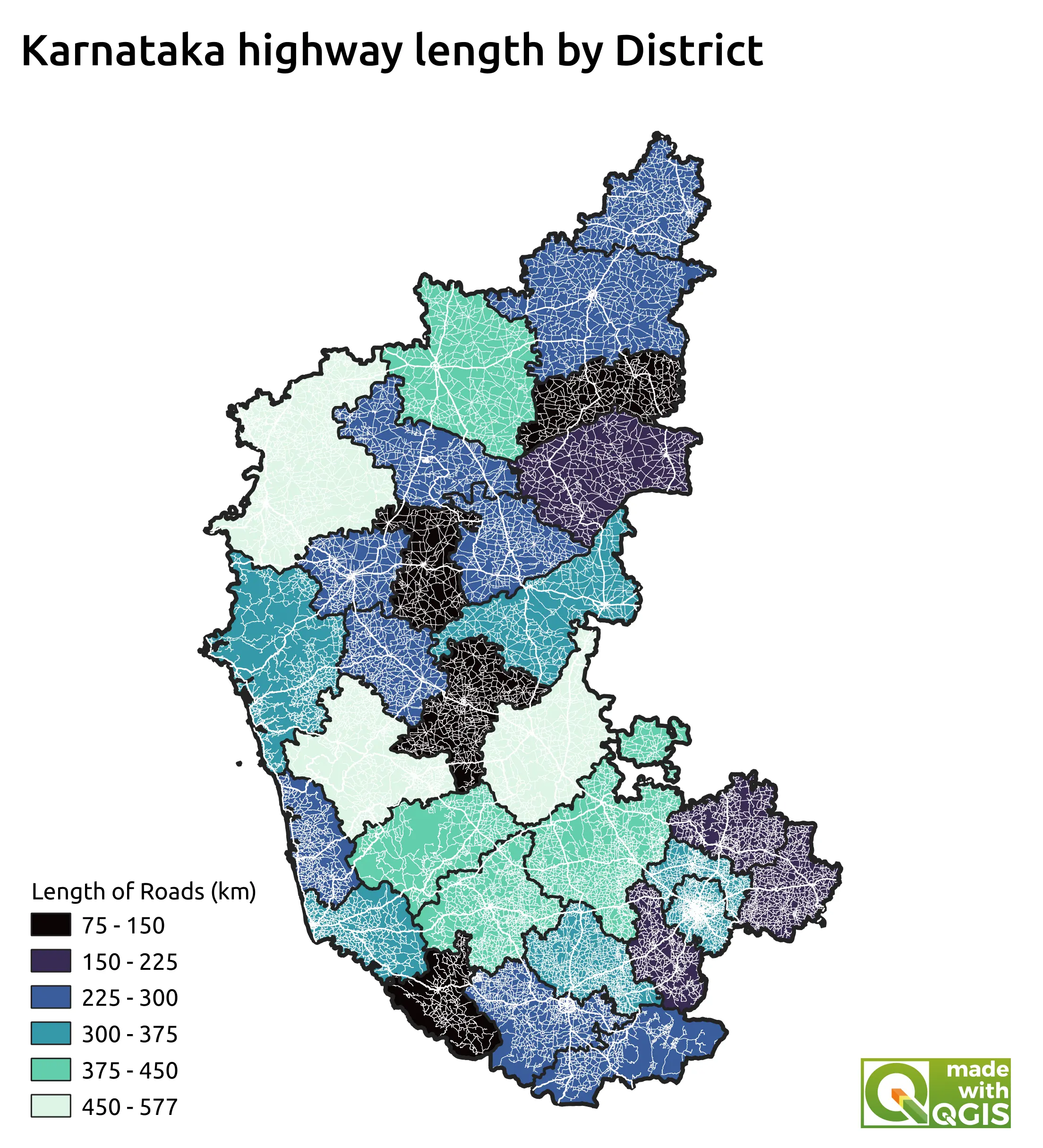
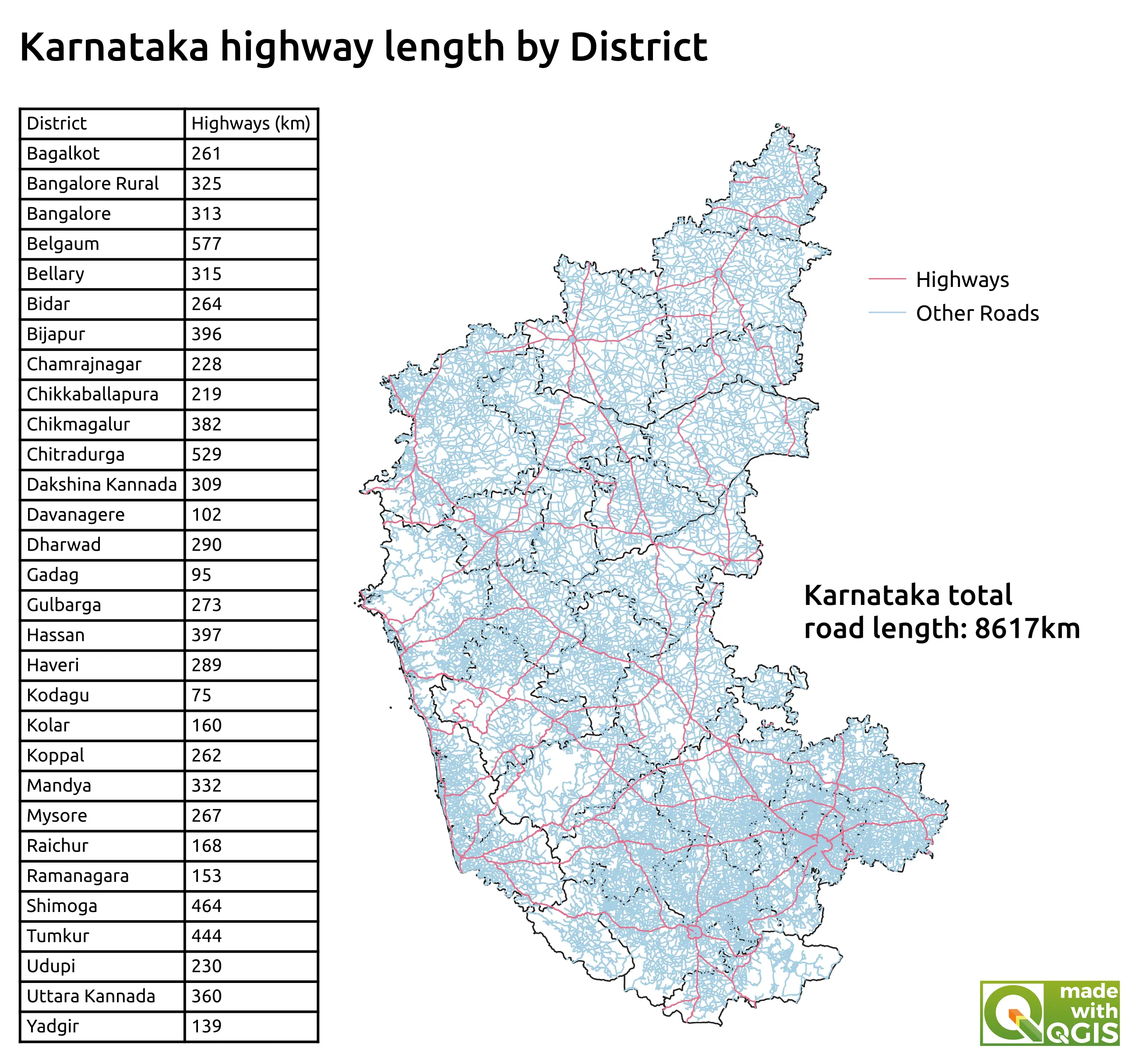
This project was part of the Advanced QGIS course (Part 1) by Spatial Thoughts. In this section of the course, a variety of different processing algoriths from within the processing toolbox were used to process data and conduct spatial and statistical analyses. Firstly, a file of the major roads in Karnataka was filtered using a RegEx expression and the extract by expression algorithm. The add geometry attributes algorithm was then used with an ellipsoidal method to produce distance in metres of the highways. The field calculator algorithm was then used to divide this by 1000 and convert to kilometres. The basic statistics for fields algorithm was then used to analyse the length of highways in Karnataka. Once this data had been obtained, the refactor fields algortithm was used to tidy up the attributes and remove unneccessary fields. After this, the join attributes by location algorithm was used to add data for which state each highway was in. This allowed for the grouping of highway length by district. The statistics by category algorithm was then used to analyse the lengths of highways in each of the districts. These results were then presented in a print layout. To develop my newly acquired skills, the highway length in each district which had just been calculated was joined to the Karnataka districts layer such that each district had an associated length of highways in the file. This allowed for the production of a chloropleth map (unnormalised) to highlight the length of highway in each region.